Earthquakes in Panama are stronger and more frequent than many people think. The strongest measured with modern instruments struck the Azuero Peninsula on October 9, 2026, with a magnitude of 7.7 according to the U.S. Geological Survey (USGS). The September 7, 1882, earthquake in the Gulf of San Blas is estimated at 7.9 based on historical records, according to the Institute of Geosciences at the University of Panama, and it caused the deadliest tsunami in the country’s history.
Over four centuries, the most damaging earthquakes in Panama have been concentrated in three areas: Chiriquí and the border with Costa Rica, the Caribbean coast, and now Azuero. In this article, we review those earthquakes, explain why they happen, and look at the lessons they hold for those who design and build in the country.
Why does Panama have earthquakes?
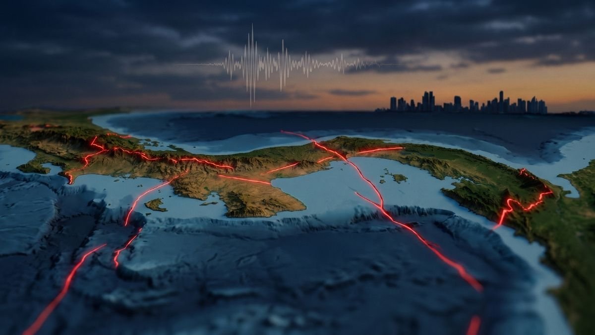
Panama shakes because the isthmus sits on the Panama microplate, surrounded by three moving plates: the Caribbean Plate to the north and the Cocos and Nazca plates to the south. Off Chiriquí, the Cocos Plate moves about 9 cm (3.5 in) per year relative to Panama. The Institute of Geosciences at the University of Panama records around 500 earthquakes a year in the country, although most are not felt.
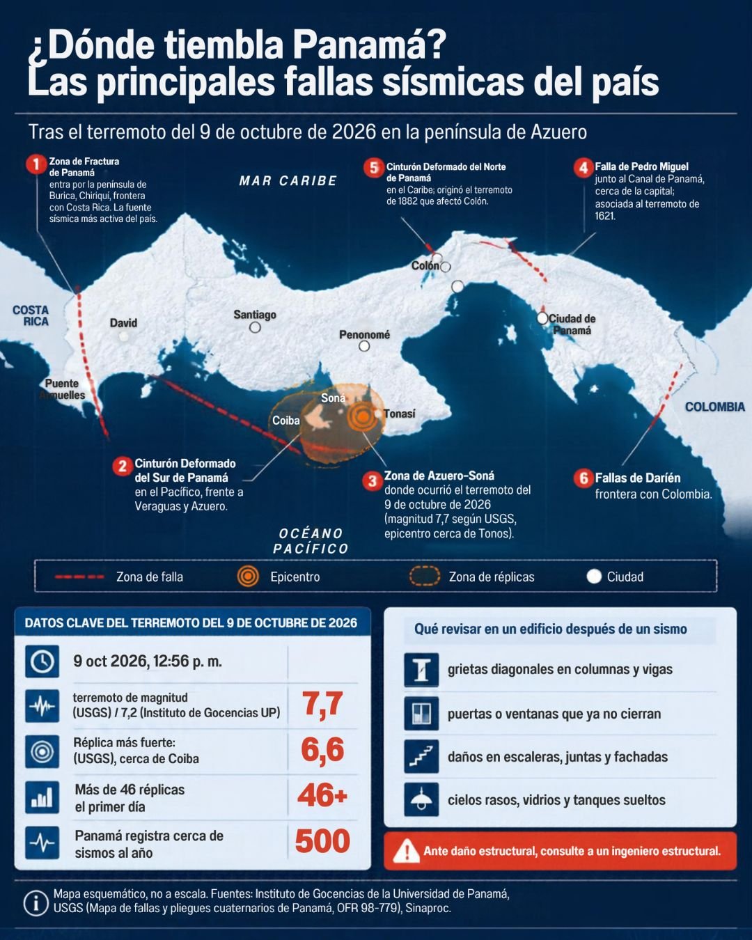
The main earthquake sources, documented in the map of Quaternary faults and folds of Panama by the USGS and the Institute of Geosciences (view the map as a PDF), are:
- Panama Fracture Zone. This is the boundary between the Cocos and Nazca plates, and it reaches land at the Burica Peninsula in Chiriquí. It is the most active seismic source in the country and, according to the USGS map, the structure with the highest slip rate: probably more than 5 mm per year.
- Azuero–Soná fault zone. It crosses the Azuero Peninsula and the Soná area, the same region where the aftershocks of the 2026 earthquake were concentrated.
- South Panama Deformed Belt. It runs through the Pacific off Veraguas and Azuero.
- North Panama Deformed Belt. It lies in the Caribbean, off Colón and Guna Yala. This is where the 1882 earthquake originated.
- Local faults in Central Panama. These include the Pedro Miguel, Gatún, and Canoas faults, next to the Canal watershed.
- Darién faults. They are located along the border with Colombia.
Timeline of earthquakes in Panama (1621–2026)
1621: the Panamá Viejo earthquake
On May 2, 1621, an earthquake with an estimated magnitude between 6.4 and 6.9 caused serious damage to the masonry buildings of Panama City, now known as Panamá Viejo. Studies by the University of Panama on the local faults of Central Panama attribute it to the Pedro Miguel Fault, next to what is now the Canal. It is the main precedent for an earthquake generated near the capital.
1882: the San Blas earthquake and tsunami
On September 7, 1882, at 3:20 a.m., a magnitude 7.9 earthquake shook the isthmus from the Gulf of San Blas, in the Caribbean. It damaged buildings in Panama and Colón and generated a tsunami that struck the islands of the San Blas archipelago, now Guna Yala. Death toll estimates range from 75 to 250 people, depending on the source. At the time, Panama was still part of Colombia.
1916: tsunami in Bocas del Toro
On April 26, 1916, an earthquake generated a tsunami that mainly affected Carenero Island in Bocas del Toro.
1934: the Puerto Armuelles earthquake
On July 18, 1934, an earthquake of magnitude 7.6–7.7 shook Puerto Armuelles in Chiriquí. It caused injuries and property damage in Puerto Armuelles and David and was felt in southern Costa Rica. The province kept shaking for more than a month.
1991: the Limón and Bocas del Toro earthquake
On April 22, 1991, a magnitude 7.7 earthquake centered in Limón, Costa Rica, hit Bocas del Toro hard. It killed 79 people in Panama and 48 in Costa Rica, and damage extended across about 20% of Panama’s territory. The Bocas del Toro coastline subsided by up to 0.9 m (3 ft), and a tsunami with waves of about 2 m (6.5 ft) reached both countries. The worst damage was to roads, bridges, ports, and water systems.
2002 and 2003: Burica and Puerto Armuelles
In July 2002, an earthquake of about magnitude 6.5 shook the Burica Peninsula. On December 25, 2003, another magnitude 6.5 earthquake in Puerto Armuelles killed two people and affected at least 600 homes.
2019: two earthquakes in Puerto Armuelles
On May 12, 2019, a magnitude 6.1 earthquake near Puerto Armuelles injured five people and caused two houses to collapse. On June 25, another magnitude 6.5 earthquake affected at least 28 homes in Puerto Armuelles, Barú, Gualaca, and David.
2026: the Azuero earthquake
On October 9, 2026, at 12:56 p.m., a magnitude 7.7 earthquake according to the USGS shook the Azuero Peninsula. The epicenter was near Tonosí and Pitaloza Arriba, at a shallow depth. The Institute of Geosciences at the University of Panama first reported it as 7.2 and later revised it to 7.5; the difference comes from the different calculation methods each agency uses. You can find all the details in our article on the Azuero earthquake.
- Aftershocks: the strongest, magnitude 6.6 according to the USGS, occurred at 3:25 p.m. near Coiba Island. More than 400 aftershocks were recorded in the first four days, concentrated between Soná, Tonosí, Coiba, and Santiago.
- Official report: according to Sinaproc bulletin No. 14, as of October 16, the earthquake left 1 dead, 27 injured, more than 20,000 people affected, and 7,406 homes assessed for damage.
- Damage: there was damage in Penonomé (the San Juan Bautista Cathedral and the provincial Governor’s Office building), Chitré, Venao, and roads in Veraguas. In Panama City, thousands of people evacuated buildings.
- Response: the Ministry of Education suspended classes nationwide, and the National Civil Protection System (Sinaproc) became the official source of information.
You can follow recent earthquakes in real time on the USGS earthquake map.
Summary: major earthquakes in Panama
| Date | Area | Magnitude | Main impact |
|---|---|---|---|
| Oct 9, 2026 | Azuero Peninsula | 7.7 (USGS) / 7.5 (IGC-UP) | 1 dead, 27 injured, and more than 20,000 affected; more than 400 aftershocks |
| Jun 25, 2019 | Puerto Armuelles, Chiriquí | 6.5 | At least 28 homes affected |
| May 12, 2019 | Puerto Armuelles, Chiriquí | 6.1 | 5 injured, 2 houses collapsed |
| Dec 25, 2003 | Puerto Armuelles, Chiriquí | 6.5 | 2 dead, about 600 homes affected |
| Jul 2002 | Burica Peninsula | ≈ 6.5 | Moderate damage |
| Apr 22, 1991 | Limón (Costa Rica) and Bocas del Toro | 7.7 | 79 dead in Panama, tsunami, coastal subsidence |
| Jul 18, 1934 | Puerto Armuelles, Chiriquí | ≈ 7.6–7.7 | Injuries and damage in Puerto Armuelles and David |
| Apr 26, 1916 | Bocas del Toro | — | Tsunami on Carenero Island |
| Sep 7, 1882 | Gulf of San Blas (Caribbean) | 7.9 (IGC-UP) | Tsunami, 75 to 250 dead depending on the source |
| May 2, 1621 | Panamá Viejo | 6.4–6.9 | Serious damage to masonry |
See the full list of earthquakes in Panama, with more events and earthquake statistics by province.
What earthquakes in Panama mean for construction
History shows that no region of the country is free from earthquakes, although the risk is not the same everywhere. Chiriquí and the border with Costa Rica have the most frequent activity; the Caribbean has produced the most destructive event; Azuero showed in 2026 that it can generate earthquakes larger than magnitude 7; and the capital, besides feeling distant earthquakes, has its own faults, such as Pedro Miguel.
For industry professionals and companies, this translates into four practices:
- Design and build in accordance with the Panama Structural Code (REP), using the seismic parameters for the project site.
- Study the soil. Fill and soft soils, common in coastal areas and on land reclaimed from the sea, amplify ground shaking.
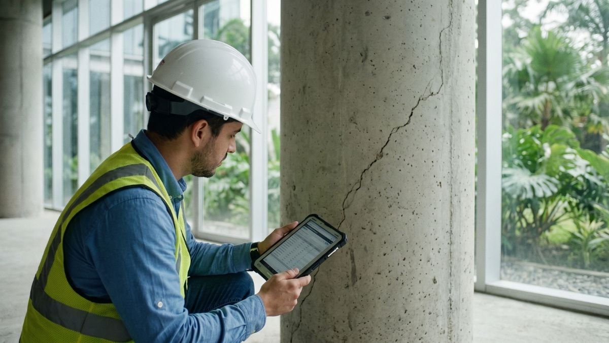
- Inspect after every strong earthquake. Diagonal cracks in columns or beams, doors that stop closing, and damage to stairs, joints, and facades require an evaluation by a structural engineer.
- Secure nonstructural elements: ceilings, glass, rooftop tanks, and unanchored equipment cause many of the injuries in an earthquake.
If your building or project needs a structural assessment, our directory lists engineering and consulting firms in Panama that specialize in design, inspection, and seismic retrofitting.
Frequently asked questions about earthquakes in Panama
What is the strongest earthquake in Panama’s history?
The strongest measured with modern instruments is the October 9, 2026, Azuero earthquake, magnitude 7.7 according to the USGS. The 1882 Gulf of San Blas earthquake is estimated at 7.9 based on historical records and is the most destructive: it caused a tsunami that killed between 75 and 250 people, depending on the source.
Is Panama a seismically active country?
Yes. Earthquakes are part of Panama’s history: the country records around 500 earthquakes a year, and since 1882 it has had at least six earthquakes of magnitude 7 or greater centered in its territory or along its borders. The belief that the country is free of earthquakes is false.
Which part of Panama has the most earthquakes?
Chiriquí, especially Puerto Armuelles, the Burica Peninsula, and the border with Costa Rica, because of their proximity to the Panama Fracture Zone. They are followed by southern Azuero, the Caribbean (northern Colón and Guna Yala), and the border with Colombia.
Could a strong earthquake hit Panama City?
Yes, although it is less frequent than in Chiriquí. The Pedro Miguel Fault, next to the Canal, is associated with the 1621 earthquake that damaged Panamá Viejo. The capital also feels distant earthquakes strongly, such as those of 1882 and 2026.
Has Panama had tsunamis?
Yes. The most significant were the 1882 tsunami in San Blas, the 1916 tsunami in Bocas del Toro, and the 1991 tsunami after the Limón earthquake.
Which institution reports earthquakes in Panama?
The Institute of Geosciences at the University of Panama (IGC-UP) records and reports earthquakes. The National Civil Protection System (Sinaproc) is the official source on damage and emergencies. The emergency number is 911.