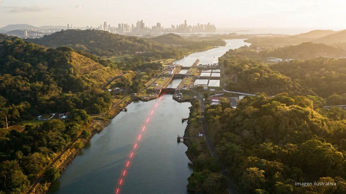
The Pedro Miguel Fault is an active fault that runs north to south alongside the Panama Canal, a few kilometers from the capital. It is the most likely cause of the May 2, 1621, earthquake that severely damaged the city of Panamá Viejo. Studies carried out for the Canal expansion confirmed that it has produced at least three large earthquakes in the last 1,600 years.
Because it is so close to the country’s most populated city and its most important infrastructure, the Pedro Miguel Fault is one of the most studied seismic sources in Panama. In this article, we explain what it is, where it runs, how active it is, and what it means for those who design and build in the metropolitan region.
What is the Pedro Miguel Fault?
The Pedro Miguel Fault is a right-lateral (dextral) strike-slip fault: the blocks of ground on each side move horizontally, and the side opposite the observer moves to the right. It is at least 30 km (19 miles) long on land and takes its name from the Pedro Miguel area in the Canal watershed, home to the locks of the same name.
Together with the Limón Fault, farther north, it forms a fault system that extends at least 40 km (25 miles) from Colón province. Both absorb part of the deformation caused by the collision between Central America and South America, according to the study on the neotectonics and paleoseismology of the Limón and Pedro Miguel faults published in 2010 in the Bulletin of the Seismological Society of America.
For decades, it was thought to be inactive. In fact, it does not appear by name on the 1998 map of Quaternary faults and folds of Panama. It was the excavations and geological mapping carried out for the Canal expansion that showed it has moved several times over the last few thousand years.
Where does the Pedro Miguel Fault run?
The Pedro Miguel Fault runs north to south through the Canal watershed, roughly parallel to its western bank, in the area between Gatún Lake and the Pacific coast. Some studies cited by the University of Panama suggest it could extend north toward Chilibre and south under the sea toward Taboga Island.
- It crosses the Canal area, but it does not run directly under the locks, according to geologist Thomas Rockwell, lead author of the studies on the fault.
- It crosses the Borinquén Dam, one of the dams that form the approach channel to the new Pacific locks. That is why its design had to account for possible ground displacement beneath the dam itself.
- It is a few kilometers from Panama City, Arraiján, and La Chorrera, the most populated area in the country.
To see the country’s other seismic sources and how they are distributed, read our history of earthquakes in Panama.
The 1621 Panamá Viejo earthquake
On May 2, 1621, two strong shocks struck the city of Panama, now Panamá Viejo. The second, in the afternoon, was the most violent and was followed by many aftershocks. Stone and masonry buildings were the hardest hit: the Convent of La Concepción suffered the worst damage, and more than 20 stone houses were damaged, while wooden houses withstood the shaking.
Studies attribute that earthquake to the Pedro Miguel Fault:
- Displacement: the old Camino de Cruces, the colonial route across the isthmus, was cut and offset by about 3 meters (10 ft). At the Borinquén Dam site, a displacement of 3.1 m from that same event was measured.
- Magnitude: estimates range from 6.4 to 6.9. A 2023 study by the University of Panama, based on the damage described in historical documents, puts it at 6.4 ± 0.4.
- Source: the lack of damage in Portobelo and Natá points to a very shallow source close to the Pacific coast.
Is the Pedro Miguel Fault still active?
Yes. The Pedro Miguel Fault has produced at least three surface-rupturing earthquakes in the last 1,600 years, with a cumulative displacement of at least 8.1 meters (27 ft). That is equivalent to one large earthquake every few centuries, and the last one was a little more than 400 years ago.
- Slip rate: the 2010 study estimated it at about 5 mm per year. More recent measurements, compiled by the University of Panama in 2023, put it at 2 to 3 mm per year.
- Potential magnitude: on its own, the fault has generated earthquakes of magnitude 6.5 or greater. If it ruptures together with the Limón Fault, the system could produce earthquakes of magnitude 7 or greater, with ruptures longer than 40 km and displacements of 2 to 3 meters.
- Forecast: no one can predict when the next earthquake will occur. The authors of the studies have declined to give a date and simply point out that the risk is real.
Both studies reach the same conclusion: the Limón–Pedro Miguel fault system poses a significant seismic hazard to the Canal and to Panama City. The technical details are in the University of Panama study on earthquakes from local faults in Central Panama (in Spanish).
November 4, 2026 earthquake: fresh evidence the fault is still active
On Wednesday, November 4, 2026, at 5:38 p.m. local time, a magnitude 3.9 earthquake centered about 4 km (2.5 mi) northwest of Arraiján, roughly 20 km (12 mi) from downtown Panama City, shook the metropolitan area. The event had a shallow depth of about 5 km and was felt across several areas of Panamá Oeste and the capital.
Néstor Luque, director of the University of Panama’s Instituto de Geociencias, linked the event directly to the Pedro Miguel Fault: «Por la ubicación de este evento, lo relacionamos con un movimiento en la falla de Pedro Miguel» (“Based on this event’s location, we’re linking it to movement on the Pedro Miguel Fault,” in Spanish). Panama’s national civil-protection agency (Sinaproc) reported no injuries or material damage, though it recommended checking homes and keeping evacuation routes clear.
These parameters are preliminary and may be revised after the final instrumental analysis. You can follow Panama’s recent seismic activity in our list of earthquakes in Panama.
How many faults are there in Panama?
Panama has dozens of fault lines. The map of Quaternary faults by the USGS and the Institute of Geosciences at the University of Panama catalogs 22 main structures, divided into more than 40 sections, and later studies have added others, such as the Pedro Miguel Fault itself. The most important are:
- Panama Fracture Zone, in Chiriquí and along the border with Costa Rica: the most active seismic source in the country.
- Azuero–Soná fault zone, in the region of the October 9, 2026, earthquake.
- North and South Panama Deformed Belts, in the Caribbean and the Pacific.
- Central Panama faults: Pedro Miguel, Limón, and Río Gatún, next to the Canal watershed.
- Darién faults, along the border with Colombia.
In our history of earthquakes in Panama, you will find which earthquake is associated with each of these areas.
What the Pedro Miguel Fault means for construction
The Pedro Miguel Fault’s proximity to the metropolitan region has direct consequences for housing, infrastructure, and building projects. The Canal expansion is the best example: the Borinquén Dam was designed to withstand the fault moving beneath its foundations, based on the 3.1 m displacement measured from the 1621 earthquake.
For professionals and companies working between Colón and the Pacific coast, this translates into five practices:
- Design in accordance with the Panama Structural Code (REP), using the seismic parameters for the project site.
- Check the location of the fault before planning linear infrastructure that could cross it, such as pipelines, roads, bridges, or power lines.
- Commission geotechnical and soil studies, especially on fill and soft soils, which amplify ground shaking.
- Assess older masonry buildings, the type of construction that suffered most in 1621.
- Inspect structures after every strong earthquake and anchor ceilings, glass, tanks, and equipment.
If your project needs a geotechnical study or a structural assessment, our directory lists engineering and consulting firms in Panama that specialize in design, inspection, and seismic retrofitting.
Frequently asked questions about the Pedro Miguel Fault
What is the Pedro Miguel Fault?
It is an active right-lateral strike-slip fault, at least 30 km long, that runs north to south alongside the Panama Canal. It is believed to have caused the 1621 earthquake that damaged Panamá Viejo.
Where does the Pedro Miguel Fault run?
It runs north to south through the Panama Canal watershed, parallel to its western bank, between Gatún Lake and the Pacific coast. It crosses the Borinquén Dam of the Canal expansion and lies a few kilometers from Panama City.
When was the last earthquake on the Pedro Miguel Fault?
On May 2, 1621. It offset the ground by about 3 meters and severely damaged the stone buildings of Panamá Viejo. Its magnitude is estimated at 6.4 to 6.9.
Can the Pedro Miguel Fault cause a strong earthquake?
Yes. It has produced at least three large earthquakes in the last 1,600 years, of magnitude 6.5 or greater. If it ruptures together with the Limón Fault, it could generate an earthquake of magnitude 7 or greater. It is not possible to predict when.
How many faults are there in Panama?
Dozens. The map of Quaternary faults by the USGS and the Institute of Geosciences catalogs 22 main structures, and later studies have added others, such as the Pedro Miguel Fault. The most active is the Panama Fracture Zone, in Chiriquí.
Is the Pedro Miguel Fault the same as the San Miguel Fault?
No. The Pedro Miguel Fault is on land, next to the Canal. The San Miguel, or Las Perlas, Fault is a reverse fault in the Gulf of Panama, associated with the January 20, 1971, earthquake, magnitude 5.6 to 5.8, which was felt in the capital.
Sources
- Rockwell et al. (2010). Neotectonics and paleoseismology of the Limón and Pedro Miguel faults in Panamá: earthquake hazard to the Panamá Canal. Bulletin of the Seismological Society of America.
- Camacho and Alvarado (2023). Earthquakes from local faults reported as strong in Central Panama. REICIT journal, University of Panama (in Spanish).
- Pedro Miguel Fault displacements for the design of the Borinquén Dam, Panama Canal expansion (16th World Conference on Earthquake Engineering, 2017).
- Map of Quaternary faults and folds of Panama (USGS and Institute of Geosciences, 1998).